InSAR for bridges and dams: what satellites can and cannot see
InSAR can show whether a pylon, an abutment or a dam body is settling, but only where the radar signal is stable. Knowing where it works is half the job.
Bridges and dams are some of the most valuable structures an owner manages, and some of the hardest to watch continuously. They are long, often over water, and exposed to weather. Survey points are few and far apart.
Radar satellites look at them anyway. Sentinel-1 passes over the same place about every 12 days, day or night, through cloud. Comparing those passes with InSAR reveals small movements of the ground and of hard surfaces such as decks, pylons and concrete faces.
Here is what InSAR can see on these structures, where it struggles, and how PILLAR turns the rates into something an asset owner can use.
Category: Technology
InSAR measures movement where the radar echo stays stable
InSAR works by comparing the phase of radar echoes from two dates. If a surface reflects the signal in a consistent way, a change in phase means the surface moved toward or away from the satellite. Concrete, steel and rock usually reflect consistently, which is why pylons, abutments, approach embankments and dam crests often give good results.
Public products make this easier to start. NASA’s ARIA project publishes Sentinel-1 geocoded unwrapped interferograms (GUNW) through the Alaska Satellite Facility, and the ASF HyP3 service can generate interferograms on demand where public pairs are scarce.
From radar passes to a rate per cell
Sentinel-1 images the same area about 12 days apart.
Phase differences form a pair (GUNW or HyP3).
Vertical displacement per pair becomes mm per year.
Rates are compared with the structure-type screen.
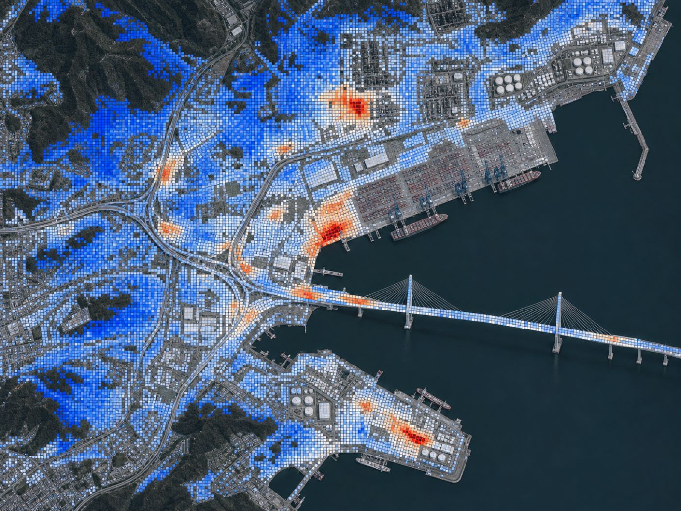
PILLAR uses 80 m cells and needs at least 4 pairs over 180 days before a rate enters the index.
Water, traffic and vegetation make cells unreliable
Water never reflects the same way twice, so reservoir surfaces and the sea under a bridge give no usable signal. Moving traffic on a deck, snow on a dam crest and vegetation on embankments can also break the comparison between dates. A good workflow marks these cells as uncertain rather than guessing.
The number of observations matters too. Two pairs over two months are not enough to call a yearly rate. In PILLAR, rates from fewer than four pairs or a period shorter than 180 days are shown as indicative only and kept out of the health index.
A rate only means something next to a screen
Is 3 mm per year a lot? For a long-span bridge, PILLAR’s default screen is 5 mm/yr with an angular distortion of 1/500. For a dam body it is 3 mm/yr and 1/1000. The same rate can be ordinary for one structure and worth a closer look for another.
Angular distortion matters as much as the rate. Two pylons settling together are less worrying than one settling faster than the other. PILLAR compares neighbouring cells and reports the differential rate alongside the maximum.
Default PILLAR screens
5 mm/yr
1/500
3 mm/yr
1/1000
4 mm/yr
1/500
2 mm/yr
1/1000
Owners can replace defaults with their own design criteria.
InSAR is a screen for where to survey, not a survey
InSAR does not replace levelling, GNSS or on-structure sensors. It covers what they cannot: every cell, every pass, without equipment. The practical use is to decide where those precise methods should go first, and to compare their results side by side later.
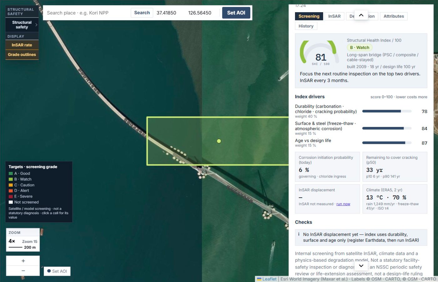
So far we have looked at what InSAR can and cannot see on bridges and dams. You can read more about how PILLAR uses it on the InSAR displacement page.
Frequently asked questions
Can InSAR see a bridge deck move under traffic?
Not reliably. Moving vehicles change the echo between dates. InSAR is better at slow, long-term movement of pylons, abutments and approaches.
How often is data updated?
Sentinel-1 revisits about every 12 days. NISAR adds more radar data as it becomes available.
Is the data free?
Sentinel-1 data and public ARIA products are free. Commercial high-resolution SAR is available at data cost.
Not sure which structure to inspect first?
We can start with a screening of your structures from public satellite and climate data.
Request a pilot →Edited and answered by the MomentCube PILLAR team / james@momentcube.com · +82-32-212-1011